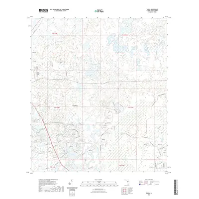
2021 Map of Ehren
USGS Topo · Published 2021About this map
Ehren and Connerton anchor this modern survey of Pasco County, illustrating the contemporary suburban transition of central Florida. The landscape is defined by a dense network of hydrographic features, ranging from the expansive Big Cypress Swamp to smaller water bodies like Bird Island Lakes, Red Bug Lake, and Goose Lake. These wetlands and ponds are interspersed with residential development, where winding roads like Pleasant Plains Pkwy and Wilderness Lake Blvd now navigate through the terrain. The presence of Pilot Country Airport and the Ehren Cemetary Rd suggests the layering of modern infrastructure over older local landmarks. Further north, the landscape remains heavily dotted with water, including Big Fish Lake and Way Pond, while Fivemile Cr and Cypress Creek provide natural drainage through this low-lying region.
Find a feature on this map
82 named features on this map. Tap any name to fly to it.
Don’t see what you’re looking for? This feature index may not catch every label — zoom into the map to look around manually.
Map Details
Editions of this 2021 Ehren Map
This is the sole edition of this map. No revisions or reprints were ever made.
Other maps of this area

1943 · Odessa
USGS Topo · 1:24,000

1943 · Lutz
USGS Topo · 1:24,000

1944 · Wesley Chapel
USGS Topo · 1:31,680

1944 · Lutz
USGS Topo · 1:31,680

1944 · Odessa
USGS Topo · 1:31,680

1949 · Odessa
USGS Topo · 1:25,000

1954 · Spring Lake
USGS Topo · 1:24,000

1954 · Ehren
USGS Topo · 1:24,000

1954 · San Antonio
USGS Topo · 1:24,000

1954 · Fivay
USGS Topo · 1:24,000