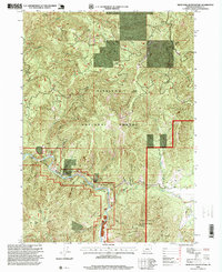
1996 Map of Eight Dollar Mountain
USGS Topo · Published 1999About this map
Siskiyou National Forest land defines this landscape in southwestern Oregon, where the steep topography of the Siskiyou Mountain range meets the winding course of the Illinois River. The river, designated here as a Wild and Scenic River, carves through deep canyons and past alluvial benches like Kerby Flat and Star Flat. This 1990s-era survey documents a landscape shaped by both natural features and resource extraction, evidenced by the Eureka Mine and numerous unnamed prospects and mines scattered across the ridges.
Find a feature on this map
31 named features on this map. Tap any name to fly to it.
Don’t see what you’re looking for? This feature index may not catch every label — zoom into the map to look around manually.
Map Details
Editions of this 1996 Eight Dollar Mountain Map
This is the sole edition of this map. No revisions or reprints were ever made.
Other maps of this area

1917 · Kerby
USGS Topo · 1:125,000

1918 · Kerby
USGS Topo · 1:125,000

1945 · Kerby
USGS Topo · 1:125,000

1954 · Cave Junction
USGS Topo · 1:62,500

1954 · Selma
USGS Topo · 1:62,500

1954 · Chetco Peak
USGS Topo · 1:62,500

1954 · Pearsoll Peak
USGS Topo · 1:62,500

1955 · Medford
USGS Topo · 1:250,000

1957 · Medford
USGS Topo · 1:250,000

1958 · Medford
USGS Topo · 1:250,000