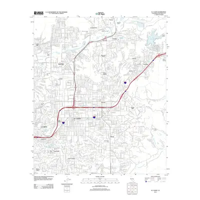
2012 Map of El Cajon
USGS Topo · Published 2012About this map
The San Diego River corridor anchors this portrait of East County's expanding suburban landscape in the early 21st century. The valley floor is heavily developed, with the major hubs of El Cajon, Santee, and La Mesa forming a continuous urban fabric connected by the freeway system. Notable landmarks of the era include the Santee Drive-In and Cajon Speedway, reflecting the region's long-standing automotive and recreational culture. Higher elevations like Mount Helix, topped by the Helix Cross, provide a stark contrast to the dense residential grids of Bostonia and Winter Gardens below.
Find a feature on this map
56 named features on this map. Tap any name to fly to it.
Don’t see what you’re looking for? This feature index may not catch every label — zoom into the map to look around manually.
Map Details
Editions of this 2012 El Cajon Map
This is the sole edition of this map. No revisions or reprints were ever made.
Other maps of this area

1893 · El Cajon
USGS Topo · 1:62,500

1901 · Elcajon
USGS Topo · 1:62,500

1903 · Cuyamaca
USGS Topo · 1:125,000

1903 · La Jolla
USGS Topo · 1:62,500

1903 · Elcajon
USGS Topo · 1:62,500

1904 · San Diego
USGS Topo · 1:62,500

1904 · Southern California Sheet No. 2
USGS Topo · 1:250,000

1930 · La Jolla
USGS Topo · 1:62,500

1930 · San Diego
USGS Topo · 1:62,500

1939 · El Cajon
USGS Topo · 1:62,500