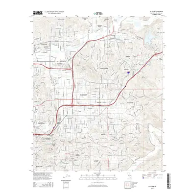
2015 Map of El Cajon
USGS Topo · Published 2015About this map
El Cajon serves as the central hub of this inland valley, where the urban sprawl of San Diego meets the complex terrain of eastern San Diego County. In the mid-2010s, this area shows a dense network of suburban development stretching from Santee and La Mesa into the foothills, punctuated by distinctive landmarks like Gillespie Field and the San Diego Christian College. The landscape is defined by the San Diego River corridor to the north and the Sweetwater River in the south, with residential enclaves such as Winter Gardens, Bostonia, and Granite Hills tucked between rising slopes.
Find a feature on this map
50 named features on this map. Tap any name to fly to it.
Don’t see what you’re looking for? This feature index may not catch every label — zoom into the map to look around manually.
Map Details
Editions of this 2015 El Cajon Map
This is the sole edition of this map. No revisions or reprints were ever made.
Other maps of this area

1893 · El Cajon
USGS Topo · 1:62,500

1901 · Elcajon
USGS Topo · 1:62,500

1903 · Cuyamaca
USGS Topo · 1:125,000

1903 · La Jolla
USGS Topo · 1:62,500

1903 · Elcajon
USGS Topo · 1:62,500

1904 · San Diego
USGS Topo · 1:62,500

1904 · Southern California Sheet No. 2
USGS Topo · 1:250,000

1930 · La Jolla
USGS Topo · 1:62,500

1930 · San Diego
USGS Topo · 1:62,500

1939 · El Cajon
USGS Topo · 1:62,500