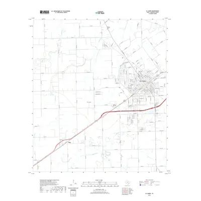
2019 Map of El Campo
USGS Topo · Published 2019About this map
El Campo serves as the central hub of this coastal prairie landscape, where the street grid of the town core transitions into a network of farm-to-market roads and county lanes. The area's drainage is defined by several waterways, including the Tres Palacios River, Blue Cr, and the branching arms of W Mustang Cr and E Mustang Cr. To the southwest, the smaller settlement of Hillje sits along the primary highway corridor, maintaining a distinct identity apart from the larger city center.
Find a feature on this map
164 named features on this map. Tap any name to fly to it.
Don’t see what you’re looking for? This feature index may not catch every label — zoom into the map to look around manually.
Map Details
Editions of this 2019 El Campo Map
This is the sole edition of this map. No revisions or reprints were ever made.
Other maps of this area

1951 · Danevang
USGS Topo · 1:24,000

1952 · Pierce
USGS Topo · 1:24,000

1953 · Glen Flora
USGS Topo · 1:24,000

1953 · Seguin
USGS Topo · 1:250,000

1958 · Seguin
USGS Topo · 1:250,000

1960 · New Taiton
USGS Topo · 1:24,000

1965 · El Campo
USGS Topo · 1:24,000

1965 · Gobbler Creek
USGS Topo · 1:24,000
1965 · El Campo SE
USGS Topo · 1:24,000
1965 · Hahn
USGS Topo · 1:24,000