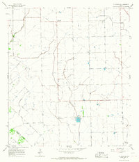
1965 Map of El Campo SE
USGS Topo · Published 1967About this map
The Hillje Oil Field dominates this mid-1960s landscape, illustrating the intensive petroleum extraction activity across this portion of Wharton County. Dozens of individual Oil Wells are scattered throughout the territory, supported by a network of pipelines and a centralized Pumping Sta. The small settlement of Plainview anchors the northern section, centered at the junction of Plainview Road and a major pipeline corridor.
Find a feature on this map
14 named features on this map. Tap any name to fly to it.
Don’t see what you’re looking for? This feature index may not catch every label — zoom into the map to look around manually.
Map Details
Editions of this 1965 El Campo SE Map
2 editions found
Other maps of this area

1951 · Danevang
USGS Topo · 1:24,000

1952 · Francitas NW
USGS Topo · 1:24,000

1952 · Francitas NE
USGS Topo · 1:24,000

1952 · Midfield
USGS Topo · 1:24,000

1952 · Pierce
USGS Topo · 1:24,000

1953 · Beeville
USGS Topo · 1:250,000

1953 · Seguin
USGS Topo · 1:250,000

1956 · Beeville
USGS Topo · 1:250,000

1958 · Seguin
USGS Topo · 1:250,000

1960 · Beeville
USGS Topo · 1:250,000