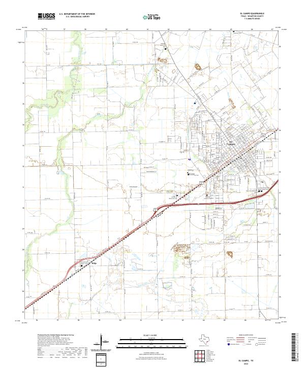
2022 Map of El Campo
USGS Topo · Published 2022About this map
El Campo serves as the focal point of this Wharton County landscape, where the convergence of rail and regional roads has long supported the agricultural economy of the Texas coastal plain. The map reveals a high concentration of significant local heritage sites, particularly a diverse collection of burial grounds such as the Swedish Lutheran Cem, La Colonia Mexicana De El Campo Cem, and Garden of Memories Cem. These locations, along with the Saint Andrews Catholic Cem in nearby Hillje, offer deep genealogical value and point to the varied immigrant and community histories that built the area.
Find a feature on this map
182 named features on this map. Tap any name to fly to it.
Don’t see what you’re looking for? This feature index may not catch every label — zoom into the map to look around manually.
Map Details
Editions of this 2022 El Campo Map
This is the sole edition of this map. No revisions or reprints were ever made.
Other maps of this area

1951 · Danevang
USGS Topo · 1:24,000

1952 · Pierce
USGS Topo · 1:24,000

1953 · Glen Flora
USGS Topo · 1:24,000

1953 · Seguin
USGS Topo · 1:250,000

1958 · Seguin
USGS Topo · 1:250,000

1960 · New Taiton
USGS Topo · 1:24,000

1965 · El Campo
USGS Topo · 1:24,000

1965 · Gobbler Creek
USGS Topo · 1:24,000
1965 · El Campo SE
USGS Topo · 1:24,000
1965 · Hahn
USGS Topo · 1:24,000