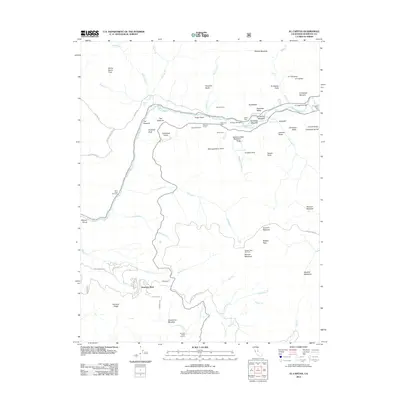
2012 Map of El Capitan
USGS Topo · Published 2012About this map
Yosemite Valley is dominated by dramatic granite formations and essential mountain crossings in this early 21st-century survey. The iconic El Capitan Bridge spans the Merced River, serving as a central point for exploring the El Capitan Moraine and nearby El Capitan Picnic Area. Notable geological features such as the Leaning Tower, Cathedral Rocks, and the Cathedral Spires flank the southern valley walls, while the engineering of the Wawona Tunnel provides a critical passage for travelers entering from the south. The map details the transition from the high-traffic valley floor to the quieter residential area of Yosemite West and the high-elevation recreation at Badger Pass Ski Area. Local landmarks like the Henness Ridge Lookout and the Arch Rock Entrance mark the periphery of this mountain landscape, while water features like Bridalveil Fall and Ribbon Fall define the vertical relief of the terrain.
Find a feature on this map
82 named features on this map. Tap any name to fly to it.
Don’t see what you’re looking for? This feature index may not catch every label — zoom into the map to look around manually.
Map Details
Editions of this 2012 El Capitan Map
This is the sole edition of this map. No revisions or reprints were ever made.
Other maps of this area

1897 · Yosemite
USGS Topo · 1:125,000

1900 · Yosemite
USGS Topo · 1:125,000

1903 · Yosemite
USGS Topo · 1:125,000

1909 · Yosemite
USGS Topo · 1:125,000

1947 · El Portal
USGS Topo · 1:24,000

1947 · Mariposa
USGS Topo · 1:250,000

1947 · El Portal
USGS Topo · 1:62,500

1947 · Buckingham Mtn
USGS Topo · 1:24,000

1948 · Mariposa
USGS Topo · 1:250,000
1949 · Buckingham Mtn
USGS Topo · 1:24,000