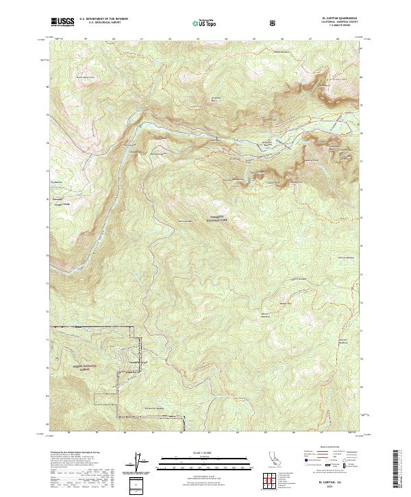
2021 Map of El Capitan
USGS Topo · Published 2021About this map
Yosemite National Park and portions of the Sierra National Forest are documented in this contemporary survey, centering on the iconic granite formations and glacially carved landscapes of the Yosemite Valley. The sheer verticality of the terrain is represented through landmarks like El Capitan, Cathedral Spires, and the Leaning Tower. This map provides a detailed view of the corridor along the Merced Wild and Scenic River, where numerous springs such as Black Spring and Fern Spring emerge below the Rockslides. Settlement patterns are concentrated in the residential community of Yosemite West and the mountain hamlet of Foresta. The survey also traces the historic transportation network, from the Old Wawona Road Trl to the high-elevation routes around Badger Pass, illustrating how the valley's rim is connected via trails like the Pohono Trl.
Find a feature on this map
127 named features on this map. Tap any name to fly to it.
Don’t see what you’re looking for? This feature index may not catch every label — zoom into the map to look around manually.
Map Details
Editions of this 2021 El Capitan Map
This is the sole edition of this map. No revisions or reprints were ever made.
Other maps of this area

1897 · Yosemite
USGS Topo · 1:125,000

1900 · Yosemite
USGS Topo · 1:125,000

1903 · Yosemite
USGS Topo · 1:125,000

1909 · Yosemite
USGS Topo · 1:125,000

1947 · El Portal
USGS Topo · 1:24,000

1947 · Mariposa
USGS Topo · 1:250,000

1947 · El Portal
USGS Topo · 1:62,500

1947 · Buckingham Mtn
USGS Topo · 1:24,000

1948 · Mariposa
USGS Topo · 1:250,000
1949 · Buckingham Mtn
USGS Topo · 1:24,000