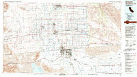
1989 Map of El Centro
USGS Topo · Published 1990About this map
Imperial Valley agriculture and the stark arid landscapes of the Yuha Desert define this transborder study. The map documents the intricate irrigation network surrounding major hubs like El Centro, Brawley, and Calexico, where the New River and Alamo River cut through the reclaimed basin. To the west, the Yuha Recreation Lands and Yuha Basin reveal specialized terrain features including the Shell Beds and Yuha Buttes.
Find a feature on this map
109 named features on this map. Tap any name to fly to it.
Don’t see what you’re looking for? This feature index may not catch every label — zoom into the map to look around manually.
Map Details
Editions of this 1989 El Centro Map
This is the sole edition of this map. No revisions or reprints were ever made.
Other maps of this area

1903 · Yuma
USGS Topo · 1:125,000

1905 · Yuma
USGS Topo · 1:125,000

1907 · Holtville
USGS Topo · 1:125,000

1915 · El Centro
USGS Topo · 1:125,000

1931 · Vallecito
USGS Topo · 1:125,000

1931 · Carrizo
USGS Topo · 1:125,000

1939 · Jacumba
USGS Topo · 1:62,500

1940 · Brawley
USGS Topo · 1:62,500

1940 · Kane Spring
USGS Topo · 1:62,500

1940 · Iris
USGS Topo · 1:62,500