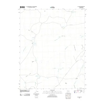
2010 Map of El Dado
USGS Topo · Published 2010About this map
Leon and El Dado anchor this high-desert landscape in McKinley County, defined by a complex network of seasonal water sources and arroyos. The topography is marked by named mesas and canyons, including White Mesa and Cliff Dwelling Canyon, which contains the noted Cliff House landmark. This region relies on a series of springs and catchments such as Coal Mine Spring, Salazar Spring, and Burro Springs, highlighting the critical importance of water management in the arid environment. A series of natural and man-made basins, from Laguna Leon to Laguna Elefante, are interconnected by drainages like Voght Draw and San Isidro Arroyo. The presence of County RD 75 and Indian Road 7028 provides the primary transit through these high plains, connecting the scattered settlements and natural landmarks such as the distinctive Piedra Camello and the prominent El Dado Peak.
Find a feature on this map
37 named features on this map. Tap any name to fly to it.
Don’t see what you’re looking for? This feature index may not catch every label — zoom into the map to look around manually.
Map Details
Editions of this 2010 El Dado Map
This is the sole edition of this map. No revisions or reprints were ever made.
Other maps of this area

1883 · Mt. Taylor
USGS Topo · 1:250,000

1886 · Mt. Taylor
USGS Topo · 1:250,000

1892 · Mt. Taylor
USGS Topo · 1:250,000

1899 · Mt. Taylor
USGS Topo · 1:250,000

1958 · Albuquerque
USGS Topo · 1:250,000

1961 · El Dado
USGS Topo · 1:24,000

1961 · Piedra De La Aguila
USGS Topo · 1:24,000

1961 · El Dado Mesa
USGS Topo · 1:24,000

1961 · Mesita Del Gavilan
USGS Topo · 1:24,000

1961 · Hospah
USGS Topo · 1:24,000