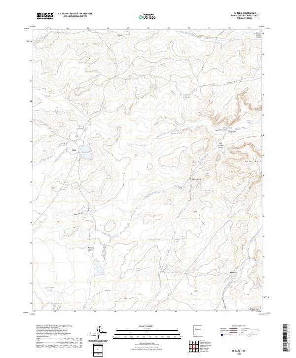
2023 Map of El Dado
USGS Topo · Published 2023About this map
El Dado and the surrounding high desert of McKinley County are defined by a complex network of arroyos and vital water sources in this 2023 survey. The landscape is marked by numerous named springs such as Peña Springs, Salazar Spring, and Montoya Spring, which historically sustained movement through this arid terrain. Topographical landmarks like Sombrero Alto and White Mesa provide navigational anchors across the quadrangle, while Cliff Dwelling Canyon hints at the deep human history inherent to the region. Water management is evident through features like Brown Tank and various lagunas, including Laguna Anaconda and Laguna Leon. These features, alongside the course of San Miguel Creek, illustrate how both natural drainage and catchment points dictate the settlement patterns of the small communities at Leon and El Dado.
Find a feature on this map
42 named features on this map. Tap any name to fly to it.
Don’t see what you’re looking for? This feature index may not catch every label — zoom into the map to look around manually.
Map Details
Editions of this 2023 El Dado Map
This is the sole edition of this map. No revisions or reprints were ever made.
Other maps of this area

1883 · Mt. Taylor
USGS Topo · 1:250,000

1886 · Mt. Taylor
USGS Topo · 1:250,000

1892 · Mt. Taylor
USGS Topo · 1:250,000

1899 · Mt. Taylor
USGS Topo · 1:250,000

1958 · Albuquerque
USGS Topo · 1:250,000

1961 · El Dado
USGS Topo · 1:24,000

1961 · Piedra De La Aguila
USGS Topo · 1:24,000

1961 · El Dado Mesa
USGS Topo · 1:24,000

1961 · Mesita Del Gavilan
USGS Topo · 1:24,000

1961 · Hospah
USGS Topo · 1:24,000