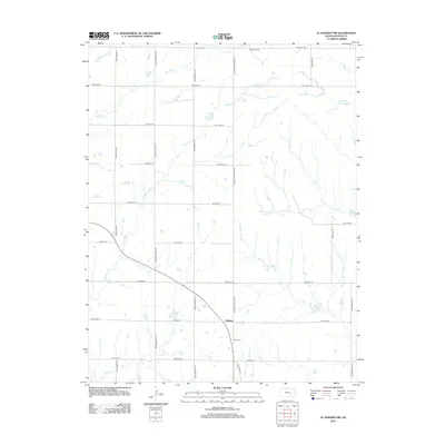
2012 Map of El Dorado NW
USGS Topo · Published 2012About this map
Hopkins serves as a central waypoint in this section of Butler County, situated along the crossroads of NW Hopkins Switch Rd and NW 60th St. The surrounding landscape is defined by the complex drainage of the E Br Whitewater River and its various tributaries, including the winding paths of Fourmile Cr and Rock Cr. To the north, the presence of the Hazlett Oil Field indicates the region's historical and ongoing ties to petroleum extraction, a significant industry for this part of the Kansas prairie. Genealogists and local historians will find the Baker Cem noted just south of the main settlement. The map illustrates a strictly gridded rural road system, reflecting the township-and-range land division that characterizes the American Midwest, where paths like NW Ohio Street Rd and NW Shumway Rd segment the agricultural and industrial terrain.
Find a feature on this map
26 named features on this map. Tap any name to fly to it.
Don’t see what you’re looking for? This feature index may not catch every label — zoom into the map to look around manually.
Map Details
Editions of this 2012 El Dorado NW Map
This is the sole edition of this map. No revisions or reprints were ever made.
Other maps of this area

1888 · Eldorado
USGS Topo · 1:125,000

1889 · Newton
USGS Topo · 1:125,000

1889 · Wichita
USGS Topo · 1:125,000

1894 · Wichita
USGS Topo · 1:125,000

1894 · Newton
USGS Topo · 1:125,000

1898 · Cottonwood Falls
USGS Topo · 1:125,000

1955 · Benton
USGS Topo · 1:24,000

1955 · Wichita
USGS Topo · 1:250,000

1955 · Hutchinson
USGS Topo · 1:250,000

1958 · Wichita
USGS Topo · 1:250,000