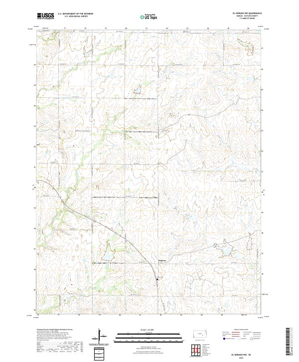
2022 Map of El Dorado NW
USGS Topo · Published 2022About this map
Hopkins serves as a central landmark in this Butler County landscape, situated near the intersection of modern rural routes and historical property divisions. The area is defined by its drainage into the Walnut River basin, with Diamond Cr flowing across the northern sections and Fourmile Cr winding through the southwest. These waterways historically dictated the placement of early homesteads and agricultural boundaries, a pattern still visible in the grid of local roads like NW Ohio Street Rd and NW Shumway RD.
Find a feature on this map
29 named features on this map. Tap any name to fly to it.
Don’t see what you’re looking for? This feature index may not catch every label — zoom into the map to look around manually.
Map Details
Editions of this 2022 El Dorado NW Map
This is the sole edition of this map. No revisions or reprints were ever made.
Other maps of this area

1888 · Eldorado
USGS Topo · 1:125,000

1889 · Newton
USGS Topo · 1:125,000

1889 · Wichita
USGS Topo · 1:125,000

1894 · Wichita
USGS Topo · 1:125,000

1894 · Newton
USGS Topo · 1:125,000

1898 · Cottonwood Falls
USGS Topo · 1:125,000

1955 · Benton
USGS Topo · 1:24,000

1955 · Wichita
USGS Topo · 1:250,000

1955 · Hutchinson
USGS Topo · 1:250,000

1958 · Wichita
USGS Topo · 1:250,000