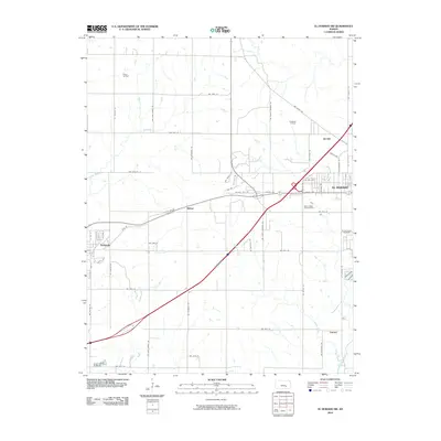
2010 Map of El Dorado SW
USGS Topo · Published 2010About this map
Pierce Oil Field and the El Dorado Oil Field dominate the landscape of this Butler County region, illustrating the enduring industrial legacy of the Kansas plains. The map centers on the small settlements of Midian and Oil Hill, communities historically shaped by the petroleum sector, while the larger town of El Dorado occupies the eastern edge. The Walnut River and Sutton Creek cut through the gridded road network, providing natural drainage for the surrounding oil-producing lands. Cultural landmarks such as Sunset Lawns Cemetery and Walnut Valley Memorial Park are located near the population centers, while the western reaches include the town of Towanda. This survey captures the transition from residential hubs to wide-open extraction fields, connected by a network of rural routes like NW Purity Springs Rd and NW Ohio Street Rd.
Find a feature on this map
58 named features on this map. Tap any name to fly to it.
Don’t see what you’re looking for? This feature index may not catch every label — zoom into the map to look around manually.
Map Details
Editions of this 2010 El Dorado SW Map
This is the sole edition of this map. No revisions or reprints were ever made.
Other maps of this area

1888 · Eldorado
USGS Topo · 1:125,000

1889 · Wichita
USGS Topo · 1:125,000

1894 · Wichita
USGS Topo · 1:125,000

1955 · Santa Fe Lake
USGS Topo · 1:24,000

1955 · Benton
USGS Topo · 1:24,000

1955 · Wichita
USGS Topo · 1:250,000

1958 · Wichita
USGS Topo · 1:250,000

1961 · Augusta
USGS Topo · 1:24,000

1961 · De Graff
USGS Topo · 1:24,000

1961 · El Dorado NW
USGS Topo · 1:24,000