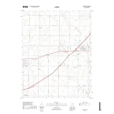
2018 Map of El Dorado SW
USGS Topo · Published 2018About this map
El Dorado and its western outskirts anchor this landscape in Butler County, where the plains are etched by the Walnut River and its numerous tributaries. The settlement pattern here reflects the agricultural and industrial legacy of the region, featuring several small communities and hamlets such as Midian, Oil Hill, and Vanora that dot the prairie along the drainage of Sutton Cr and Constant Cr. The presence of Oil Hill particularly highlights the area's historical connection to the Kansas petroleum industry. To the west, the town of Towanda sits near the headwaters of Spring Br, connected to the county seat by SW Old Hwy 254. Genealogists will find significant value in the documentation of local burial grounds, including the Towanda Cem, Sunset Lawns Cem, and Walnut Valley Memorial Park, which serve as vital markers of the area's early settlement families and growth.
Find a feature on this map
35 named features on this map. Tap any name to fly to it.
Don’t see what you’re looking for? This feature index may not catch every label — zoom into the map to look around manually.
Map Details
Editions of this 2018 El Dorado SW Map
This is the sole edition of this map. No revisions or reprints were ever made.
Other maps of this area

1888 · Eldorado
USGS Topo · 1:125,000

1889 · Wichita
USGS Topo · 1:125,000

1894 · Wichita
USGS Topo · 1:125,000

1955 · Santa Fe Lake
USGS Topo · 1:24,000

1955 · Benton
USGS Topo · 1:24,000

1955 · Wichita
USGS Topo · 1:250,000

1958 · Wichita
USGS Topo · 1:250,000

1961 · Augusta
USGS Topo · 1:24,000

1961 · De Graff
USGS Topo · 1:24,000

1961 · El Dorado NW
USGS Topo · 1:24,000