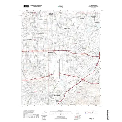
2018 Map of El Monte
USGS Topo · Published 2018About this map
El Monte and its surrounding San Gabriel Valley communities appear as a dense suburban landscape where natural drainage systems have been transformed into a highly managed hydraulic network. The Rio Hondo and San Gabriel River are central features, flanked by the extensive Whittier Narrows spreading ground and the recreational waters of Legg Lake. This 2018 survey illustrates the complex coordination of land use, from the industrial corridors in Industry and Pico Rivera to the sprawling grounds of the Rose Hills Memorial Park - Cem. In the southern portion of the map, the terrain rises into the Montebello Hills and the Puente Hills, providing a vertical contrast to the grid-iron residential patterns of Temple City, Rosemead, and Alhambra. Local transportation and education hubs are well-defined, including the San Gabriel Valley Airport and campuses for the Univ of the West and Pasadena City College-Rosemead Campus.
Find a feature on this map
65 named features on this map. Tap any name to fly to it.
Don’t see what you’re looking for? This feature index may not catch every label — zoom into the map to look around manually.
Map Details
Editions of this 2018 El Monte Map
This is the sole edition of this map. No revisions or reprints were ever made.
Other maps of this area

1894 · Los Angeles
USGS Topo · 1:62,500

1894 · Pomona
USGS Topo · 1:62,500

1896 · Pasadena
USGS Topo · 1:62,500

1896 · Anaheim
USGS Topo · 1:62,500

1896 · Downey
USGS Topo · 1:62,500

1897 · Pomona
USGS Topo · 1:62,500

1898 · Pomona
USGS Topo · 1:62,500

1898 · Anaheim
USGS Topo · 1:62,500

1899 · Downey
USGS Topo · 1:62,500

1900 · Pasadena
USGS Topo · 1:62,500