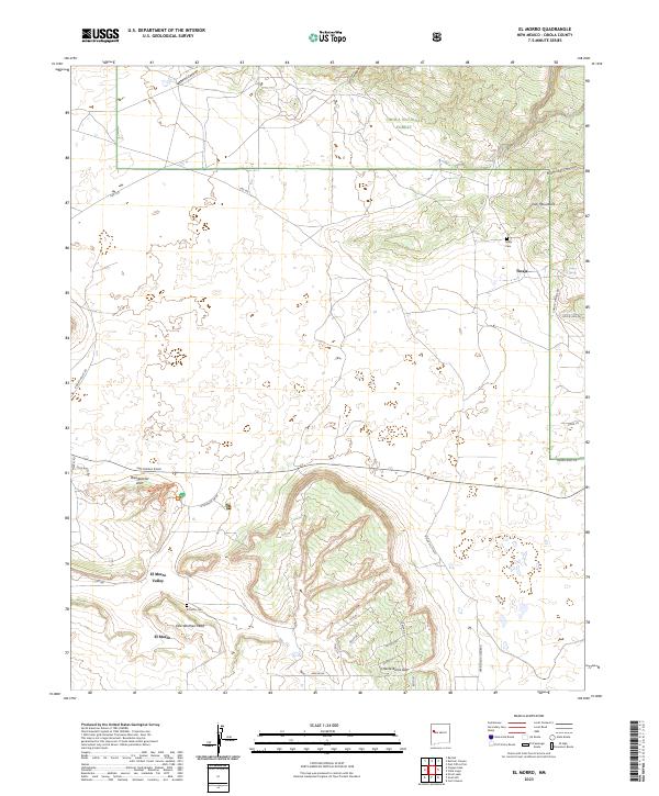
2023 Map of El Morro
USGS Topo · Published 2023About this map
El Morro National Monument dominates the southwestern landscape of this quadrangle, preserving the distinctive geological and cultural heritage of the Zuñi Mountains region. The terrain is defined by dramatic mesas and deep drainages, including Muerto Canyon and Lily Canyon to the north, which cut through the protected lands of the Cibola National Forest. The settlement pattern centers on small communities like Tinaja and the El Morro Valley, where local history is anchored by sites such as the Tinaja Cem and El Morro Cem. Natural landmarks like Woodpecker Arch and Obe Worthen Mesa reflect the characteristic sandstone formations of the high desert. A network of rural roads, such as San Rafael Road and Indian Svc Rte 47, connects these remote outposts, tracing the contours of the high-elevation valleys and gaps like Charlie Barns Gap.
Find a feature on this map
43 named features on this map. Tap any name to fly to it.
Don’t see what you’re looking for? This feature index may not catch every label — zoom into the map to look around manually.
Map Details
Editions of this 2023 El Morro Map
This is the sole edition of this map. No revisions or reprints were ever made.
Other maps of this area

1886 · Wingate
USGS Topo · 1:250,000

1892 · Wingate
USGS Topo · 1:250,000

1952 · Valle Largo
USGS Topo · 1:24,000

1952 · Post Office Flat
USGS Topo · 1:24,000

1954 · Saint Johns
USGS Topo · 1:250,000

1954 · Gallup
USGS Topo · 1:250,000

1957 · Saint Johns
USGS Topo · 1:250,000

1958 · Gallup
USGS Topo · 1:250,000

1958 · Saint Johns
USGS Topo · 1:250,000

1959 · Gallup
USGS Topo · 1:250,000
Featured Places
- Eastern Navajo Agency, NM
- Tinaja, Eastern Navajo Agency
- El Morro, Eastern Navajo Agency
- El Morro, Eastern Navajo Agency
- Sand Corner, Eastern Navajo Agency