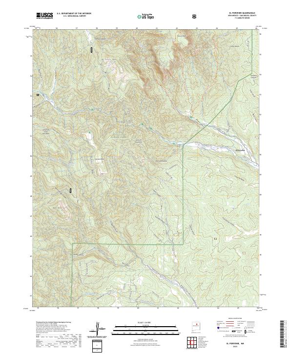
2023 Map of El Porvenir
USGS Topo · Published 2023About this map
Pecos Wilderness and the Santa Fe National Forest dominate this landscape within the Sangre de Cristo Mountains, where high-elevation landmarks like Hermit Peak and El Cielo Mtn rise above the complex canyon systems of north-central New Mexico. The small settlement of El Porvenir sits at the eastern edge of the forest, serving as a gateway to the mountains where Gallinas Creek and its tributaries carve deep through the terrain.
Find a feature on this map
62 named features on this map. Tap any name to fly to it.
Don’t see what you’re looking for? This feature index may not catch every label — zoom into the map to look around manually.
Map Details
Editions of this 2023 El Porvenir Map
This is the sole edition of this map. No revisions or reprints were ever made.
Other maps of this area

1889 · Las Vegas
USGS Topo · 1:125,000

1889 · Santa Fe
USGS Topo · 1:125,000

1891 · Las Vegas
USGS Topo · 1:125,000

1893 · Las Vegas
USGS Topo · 1:125,000

1894 · Santa Fe
USGS Topo · 1:125,000

1954 · Santa Fe
USGS Topo · 1:250,000

1958 · Santa Fe
USGS Topo · 1:250,000

1961 · San Geronimo
USGS Topo · 1:24,000

1961 · El Porvenir
USGS Topo · 1:24,000

1961 · Montezuma
USGS Topo · 1:24,000