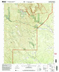
2002 Map of El Porvenir
USGS Topo · Published 2003About this map
Santa Fe National Forest and the Pecos Wilderness dominate this high-altitude landscape in San Miguel County, where steep canyons and mesas define the local geography. The settlement of El Porvenir sits at the foot of Hermit Peak, serving as a gateway to the mountains where Gallinas Creek and Porvenir Canyon converge. This area is characterized by a mix of recreational and agricultural land use, evidenced by the presence of both the San Antonio Ch and several established camps like Western Life Camp and Blue Haven Camp. Historical land divisions are clearly marked along the West Boundary Las Vegas Grant, which separates the forest from private holdings such as the Beisman Ranch and Trujillo Ranch. The map captures the complex terrain of Johnson Mesa and Bear Mountain, where numerous seasonal drainages like Tecolote Creek begin their descent toward the plains.
Find a feature on this map
45 named features on this map. Tap any name to fly to it.
Don’t see what you’re looking for? This feature index may not catch every label — zoom into the map to look around manually.
Map Details
Editions of this 2002 El Porvenir Map
This is the sole edition of this map. No revisions or reprints were ever made.
Other maps of this area

1889 · Las Vegas
USGS Topo · 1:125,000

1889 · Santa Fe
USGS Topo · 1:125,000

1891 · Las Vegas
USGS Topo · 1:125,000

1893 · Las Vegas
USGS Topo · 1:125,000

1894 · Santa Fe
USGS Topo · 1:125,000

1954 · Santa Fe
USGS Topo · 1:250,000

1958 · Santa Fe
USGS Topo · 1:250,000

1961 · San Geronimo
USGS Topo · 1:24,000

1961 · El Porvenir
USGS Topo · 1:24,000

1961 · Montezuma
USGS Topo · 1:24,000