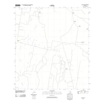
2010 Map of El Sauz
USGS Topo · Published 2010About this map
El Sauz and the surrounding ranchlands of Starr County define this South Texas landscape during the early 21st century. The map highlights the rural infrastructure of the Brush Country, where the drainage of Los Olmos Creek winds through a terrain marked by energy extraction and cattle ranching. Industrial activity is concentrated at the Sixto Oil and Gas Field in the north and the Lockhart Oil Field to the south, illustrating the region's continued reliance on petroleum resources.
Find a feature on this map
13 named features on this map. Tap any name to fly to it.
Don’t see what you’re looking for? This feature index may not catch every label — zoom into the map to look around manually.
Map Details
Editions of this 2010 El Sauz Map
This is the sole edition of this map. No revisions or reprints were ever made.
Other maps of this area

1938 · El Sauz
USGS Topo · 1:62,500

1938 · Sal Colorada
USGS Topo · 1:62,500

1949 · Mc Allen
USGS Topo · 1:250,000

1954 · McAllen
USGS Topo · 1:250,000

1956 · Garcias
USGS Topo · 1:62,500

1956 · Escobares
USGS Topo · 1:62,500

1957 · Mc Allen
USGS Topo · 1:250,000

1962 · McAllen
USGS Topo · 1:250,000
1965 · Sagunada Ranch
USGS Topo · 1:24,000
1965 · Rio Grande City North
USGS Topo · 1:24,000