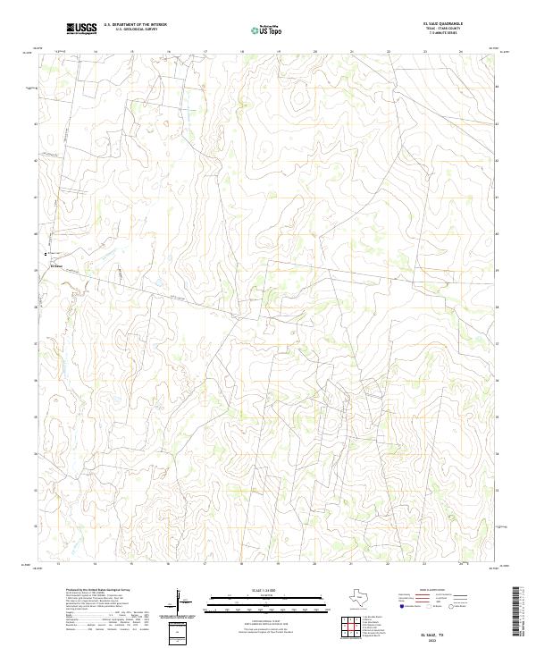
2022 Map of El Sauz
USGS Topo · Published 2022About this map
El Sauz serves as the primary focal point of this South Texas landscape, situated at the intersection of several local thoroughfares including La Morita Rd and Ranch Rd 649. The area is defined by the winding path of Los Olmos Cr, which meanders through the scrubland and ranching country of Starr County. For those tracing family histories or early settlement patterns, the El Sauz Cem provides a specific point of interest north of the main community.
Find a feature on this map
10 named features on this map. Tap any name to fly to it.
Don’t see what you’re looking for? This feature index may not catch every label — zoom into the map to look around manually.
Map Details
Editions of this 2022 El Sauz Map
This is the sole edition of this map. No revisions or reprints were ever made.
Other maps of this area

1938 · El Sauz
USGS Topo · 1:62,500

1938 · Sal Colorada
USGS Topo · 1:62,500

1949 · Mc Allen
USGS Topo · 1:250,000

1954 · McAllen
USGS Topo · 1:250,000

1956 · Garcias
USGS Topo · 1:62,500

1956 · Escobares
USGS Topo · 1:62,500

1957 · Mc Allen
USGS Topo · 1:250,000

1962 · McAllen
USGS Topo · 1:250,000
1965 · Sagunada Ranch
USGS Topo · 1:24,000
1965 · Rio Grande City North
USGS Topo · 1:24,000