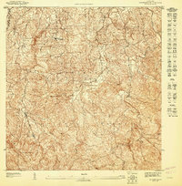
1947 Map of El Yunque NO
USGS Topo · Published 1947About this map
Caribbean National Forest dominates the Southern landscape of this mid-century topographic survey, where the steep, densely contoured ridges of the Luquillo Mountains begin their descent toward the coast. Published by the Department of the Interior under Comisionado Orlando R. Mendez, this preliminary map captures the rural character of the region during the late 1940s. The dense network of small dwellings and footpaths clustered near Escuela Casiano Cepeda reflects the traditional settlement patterns of the Municipio de Rio Grande before modern infrastructure arrived. Hydrological detail is prominent, tracing the headwaters and winding paths of the Rio Espiritu Santo and Rio Herrera as they cut through the tropical terrain. The map also delineates the administrative boundary with the Municipio de Loiza, providing a precise look at local land divisions and the placement of the Quebrada El Verde.
Find a feature on this map
6 named features on this map. Tap any name to fly to it.
Don’t see what you’re looking for? This feature index may not catch every label — zoom into the map to look around manually.
Map Details
Editions of this 1947 El Yunque NO Map
This is the sole edition of this map. No revisions or reprints were ever made.
Other maps of this area

1940 · Carolina
USGS Topo · 1:30,000

1941 · Rio Grande
USGS Topo · 1:30,000

1941 · Carolina
USGS Topo · 1:30,000

1945 · El Yunque
USGS Topo · 1:30,000

1946 · El Yunque
USGS Topo · 1:30,000

1946 · Gurabo
USGS Topo · 1:30,000

1947 · Carolina
USGS Topo · 1:30,000
1947 · El Yunque SO
USGS Topo · 1:10,000

1947 · El Yunque NE
USGS Topo · 1:10,000
1947 · Gurabo SE
USGS Topo · 1:10,000