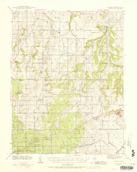
1940 Map of Elbert
USGS Topo · Published 1956About this map
Black Forest dominates the southwestern quadrant of this landscape, where the headwaters of Kettle Creek and Black Squirrel Creek originate. The high divide between the South Platte and Arkansas River drainages is meticulously documented, showing a network of rural schools that served this ranching country in the early 20th century. Elbert serves as the primary hub along Kiowa Creek, supported by smaller ranching outposts such as the Ten-Sleep Ranch and Cornforth Co Ranch.
Find a feature on this map
49 named features on this map. Tap any name to fly to it.
Don’t see what you’re looking for? This feature index may not catch every label — zoom into the map to look around manually.
Map Details
Editions of this 1940 Elbert Map
2 editions found
Other maps of this area

1893 · Big Springs
USGS Topo · 1:125,000

1893 · Colorado Springs
USGS Topo · 1:125,000

1894 · Castle Rock
USGS Topo · 1:125,000

1909 · Colorado Springs
USGS Topo · 1:125,000

1913 · Castle Rock
USGS Topo · 1:125,000

1939 · Elizabeth
USGS Topo · 1:62,500

1940 · Elbert
USGS Topo · 1:62,500
1940 · Castle Rock
USGS Topo · 1:62,500

1942 · Colorado Springs
USGS Topo · 1:125,000

1944 · Elbert
USGS Topo · 1:62,500