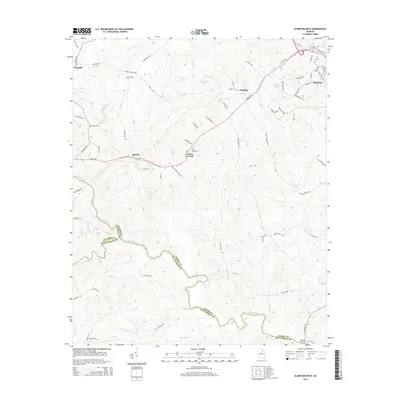
2014 Map of Elberton West
USGS Topo · Published 2014About this map
The Broad River and its major tributaries, the South Fork Broad River and Millstone Cr, define the drainage patterns of this Georgia landscape where Madison, Oglethorpe, and Elbert counties converge. Small agricultural and residential nodes like Nickville and Oglesby anchor the rural road network, while the western outskirts of Elberton appear in the northeast corner. This 2014 survey documents the persistence of local landmarks such as Mattox Bridge and family-named routes like Deadwyler Dr and Grady Cleveland Rd. Genealogists and local historians will find value in the identification of Antioch Cem and Dove Creek Cem, which remain as core historical points of reference for the communities of Dove Creek and Ethridge as the region's land use slowly shifts from traditional farm plots toward more contemporary development.
Find a feature on this map
73 named features on this map. Tap any name to fly to it.
Don’t see what you’re looking for? This feature index may not catch every label — zoom into the map to look around manually.
Map Details
Editions of this 2014 Elberton West Map
This is the sole edition of this map. No revisions or reprints were ever made.
Other maps of this area

1891 · Carnesville
USGS Topo · 1:125,000

1893 · Elberton
USGS Topo · 1:125,000

1906 · Crawfordville
USGS Topo · 1:125,000

1953 · Athens
USGS Topo · 1:250,000

1954 · Greenville
USGS Topo · 1:250,000

1958 · Greenville
USGS Topo · 1:250,000

1958 · Athens
USGS Topo · 1:250,000

1958 · Danielsville
USGS Topo · 1:62,500

1958 · Elberton
USGS Topo · 1:62,500

1959 · Athens
USGS Topo · 1:250,000