2023 Map of Eldred
USGS Topo · Published 2023About this map
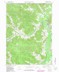
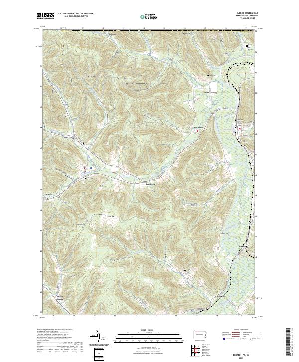
The Allegheny River meanders through the eastern portion of this corridor, where the village of Eldred serves as a primary center of settlement. This landscape in McKean County is defined by a dense network of steep valleys and hollows, including Windfall Hollow and Drake Hollow, which drain toward the river and its major tributaries like Knapp Creek. Small hamlets and crossroads such as Duke Center and Prentisvale are linked by winding valley roads, reflecting a community structure deeply tied to the local topography.
Find a feature on this map
71 named features on this map. Tap any name to fly to it.
Don’t see what you’re looking for? This feature index may not catch every label — zoom into the map to look around manually.
Map Details
Editions of this 2023 Eldred Map
This is the sole edition of this map. No revisions or reprints were ever made.