
1961 Map of Electric Mountain
USGS Topo · Published 1963About this map
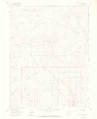
Electric Mountain dominates this portion of the Gunnison National Forest along the border of Delta and Gunnison counties. In the early 1960s, the landscape was defined by high-altitude ranching and forest management, evidenced by the Novella Bell Ranch, Flying M Ranch, and the West Muddy Ranger Sta. A distinct transportation network of Pack Trails, Jeep Trails, and the Terror Trail navigates the complex drainage basins of Muddy Creek and Hubbard Creek. Water management is visible through the winding Overland Ditch and a Gaging Sta on the creek. Geological features such as the Chimney Rocks and the Lombard Slides highlight the shifting terrain, while an isolated Landing Strip near the Flying M Ranch underscores the necessity of aerial access in this high-country environment.
Find a feature on this map
43 named features on this map. Tap any name to fly to it.
Don’t see what you’re looking for? This feature index may not catch every label — zoom into the map to look around manually.
Map Details
Editions of this 1961 Electric Mountain Map
4 editions found
Other maps of this area

1938 · Mt. Gunnison
USGS Topo · 1:48,000

1945 · Mount Gunnison
USGS Topo · 1:62,500

1956 · Montrose
USGS Topo · 1:250,000

1957 · Leadville
USGS Topo · 1:250,000

1959 · Leadville
USGS Topo · 1:250,000

1959 · Montrose
USGS Topo · 1:250,000

1960 · Leadville
USGS Topo · 1:250,000

1960 · Montrose
USGS Topo · 1:250,000

1961 · Porter Mountain
USGS Topo · 1:24,000

1961 · Chalk Mountain
USGS Topo · 1:24,000