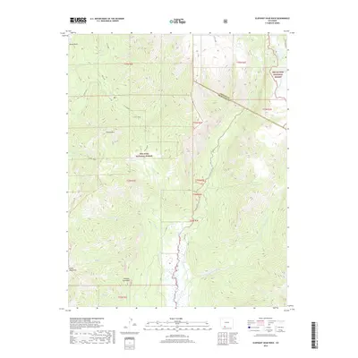
2019 Map of Elephant Head Rock
USGS Topo · Published 2019About this map
Elephant Head Rock stands as a prominent landmark in this high-altitude landscape where the San Juan National Forest meets the Rio Grande National Forest. The map documents a complex drainage system defined by the Navajo River and its numerous tributaries, including E Fork Navajo River and Beaver Cr. This area on the boundary of Conejos and Archuleta counties shows a wilderness largely shaped by its hydrology and sharp elevation changes, with named points of interest like Opal Lake and Red Falls providing specific navigational anchors for those traversing the backcountry. The presence of Blanco Basin and the Chalk Mountains suggests the geological diversity of the southern Colorado Rockies. While largely roadless, the inclusion of Valley Rd along the river bottom indicates the primary path for human transit through these steep wooded slopes.
Find a feature on this map
28 named features on this map. Tap any name to fly to it.
Don’t see what you’re looking for? This feature index may not catch every label — zoom into the map to look around manually.
Map Details
Editions of this 2019 Elephant Head Rock Map
This is the sole edition of this map. No revisions or reprints were ever made.
Other maps of this area

1913 · Summitville
USGS Topo · 1:125,000

1915 · Summitville
USGS Topo · 1:125,000

1945 · Durango
USGS Topo · 1:250,000

1953 · Durango
USGS Topo · 1:250,000

1954 · Durango
USGS Topo · 1:250,000

1957 · Chromo
USGS Topo · 1:62,500

1957 · Wolf Creek Pass
USGS Topo · 1:62,500

1957 · Chama Peak
USGS Topo · 1:62,500

1961 · Durango
USGS Topo · 1:250,000

1963 · Durango
USGS Topo · 1:250,000