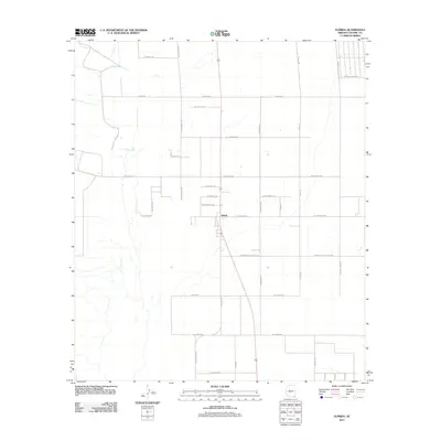
2011 Map of Elfrida
USGS Topo · Published 2011About this map
Elfrida sits at the center of this 2011 survey, serving as a primary hub for a geometric network of roads that define the agricultural and residential landscape of southern Arizona. The layout of the region is characterized by a precise grid, where thoroughfares like N Central Hwy and W Whitewater School Rd organize the land into large blocks. This system reflects the rural development of Cochise County, where local landmarks often take the form of family-named roads and localized trails. To the west, N Outlaw Trl and W Swisshelm Trl hint at the local geography and historical lore of the area. The map also captures several smaller named features and junctions such as Szyoka Rd, Chaparil, and Juaquin, which offer specific points of interest for those researching local land ownership and the evolution of this high-desert community.
Find a feature on this map
33 named features on this map. Tap any name to fly to it.
Don’t see what you’re looking for? This feature index may not catch every label — zoom into the map to look around manually.
Map Details
Editions of this 2011 Elfrida Map
This is the sole edition of this map. No revisions or reprints were ever made.
Other maps of this area

1916 · Pearce
USGS Topo · 1:125,000

1922 · Swisshelm
USGS Topo · 1:62,500

1925 · Gleeson
USGS Topo · 1:62,500

1926 · Light
USGS Topo · 1:62,500

1926 · Courtland
USGS Topo · 1:62,500

1955 · Douglas
USGS Topo · 1:250,000

1958 · Squaretop Hills
USGS Topo · 1:62,500

1958 · Swisshelm Mtn
USGS Topo · 1:62,500

1958 · Pearce
USGS Topo · 1:62,500
1958 · Gleeson
USGS Topo · 1:62,500