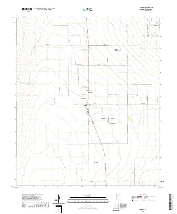
2021 Map of Elfrida
USGS Topo · Published 2021About this map
Elfrida serves as the central hub of this agricultural landscape within the Sulphur Springs Valley, where the geometric grid of modern roads meets the natural course of Whitewater Draw. The map reveals a highly structured rural settlement pattern, with long arterial routes such as N Central Hwy and N Bell Rd defining the township and range boundaries of southeastern Arizona.
Find a feature on this map
45 named features on this map. Tap any name to fly to it.
Don’t see what you’re looking for? This feature index may not catch every label — zoom into the map to look around manually.
Map Details
Editions of this 2021 Elfrida Map
This is the sole edition of this map. No revisions or reprints were ever made.
Other maps of this area

1916 · Pearce
USGS Topo · 1:125,000

1922 · Swisshelm
USGS Topo · 1:62,500

1925 · Gleeson
USGS Topo · 1:62,500

1926 · Light
USGS Topo · 1:62,500

1926 · Courtland
USGS Topo · 1:62,500

1955 · Douglas
USGS Topo · 1:250,000

1958 · Squaretop Hills
USGS Topo · 1:62,500

1958 · Swisshelm Mtn
USGS Topo · 1:62,500

1958 · Pearce
USGS Topo · 1:62,500
1958 · Gleeson
USGS Topo · 1:62,500