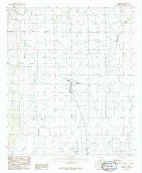
1986 Map of Elfrida
USGS Topo · Published 1986About this map
Elfrida serves as the central hub of this agricultural landscape in southeastern Arizona, situated where a cluster of grid-patterned streets meets the north-south highway. The surrounding terrain is defined by the intermittent passage of Whitewater Draw, which meanders through the western and southern reaches of the quadrangle. This 1986 survey illustrates the area's dependence on groundwater, indicated by dozens of individually marked wells scattered across the flat basin to support local ranching and farming operations. Outside the main settlement, features like the Roadside Park and a Trailer Park indicate the importance of the thoroughfare to the local economy. A Substation and various bench marks, such as BM 4150, provide technical markers for the development of infrastructure within this corner of Cochise County during the mid-1980s.
Find a feature on this map
13 named features on this map. Tap any name to fly to it.
Don’t see what you’re looking for? This feature index may not catch every label — zoom into the map to look around manually.
Map Details
Editions of this 1986 Elfrida Map
This is the sole edition of this map. No revisions or reprints were ever made.
Other maps of this area

1916 · Pearce
USGS Topo · 1:125,000

1922 · Swisshelm
USGS Topo · 1:62,500

1925 · Gleeson
USGS Topo · 1:62,500

1926 · Light
USGS Topo · 1:62,500

1926 · Courtland
USGS Topo · 1:62,500

1955 · Douglas
USGS Topo · 1:250,000

1958 · Squaretop Hills
USGS Topo · 1:62,500

1958 · Swisshelm Mtn
USGS Topo · 1:62,500

1958 · Pearce
USGS Topo · 1:62,500
1958 · Gleeson
USGS Topo · 1:62,500