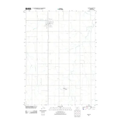
2011 Map of Elgin
USGS Topo · Published 2011About this map
Elgin and the surrounding Antelope County plains are defined by a regular grid of section roads and the meandering courses of the Blacksnake Creek and Cedar Creek. The town of Elgin serves as the primary hub, featuring the Elgin Post Office and the nearby Koinzan Airport to the north. Further south, the map documents the smaller settlement of Raeville, anchored by the Raeville Post Office. The drainage patterns of Rae Creek and other local waterways illustrate the gentle topography of this agricultural region. The network of numbered avenues and roads, such as 521 Ave and 838 Rd, provides a clear view of the rural landscape as it existed in the early twenty-first century, showing the persistent structure of Nebraska's farming communities.
Find a feature on this map
22 named features on this map. Tap any name to fly to it.
Don’t see what you’re looking for? This feature index may not catch every label — zoom into the map to look around manually.
Map Details
Editions of this 2011 Elgin Map
This is the sole edition of this map. No revisions or reprints were ever made.
Other maps of this area

1955 · Broken Bow
USGS Topo · 1:250,000

1955 · Sioux City
USGS Topo · 1:250,000

1955 · Fremont
USGS Topo · 1:250,000

1955 · O'Neill
USGS Topo · 1:250,000

1956 · Broken Bow
USGS Topo · 1:250,000

1957 · Fremont
USGS Topo · 1:250,000

1958 · Sioux City
USGS Topo · 1:250,000

1958 · Fremont
USGS Topo · 1:250,000

1959 · O'Neill
USGS Topo · 1:250,000

1959 · Sioux City
USGS Topo · 1:250,000