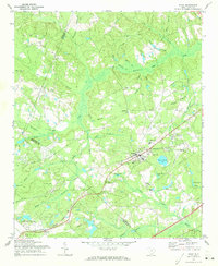
1971 Map of Elgin
USGS Topo · Published 1973About this map
The Seaboard Coast Line railroad corridor anchors the small settlements of Elgin and Pontiac in this early 1970s landscape along the Kershaw and Richland county line. This map illustrates a transition between educational research at the Clemson University Sandhill Experiment Station and the rural community life centered around numerous country churches, including Oak Grove Ch, Shady Grove Ch, and Jacob Mission Ch.
Find a feature on this map
51 named features on this map. Tap any name to fly to it.
Don’t see what you’re looking for? This feature index may not catch every label — zoom into the map to look around manually.
Map Details
Editions of this 1971 Elgin Map
2 editions found

Other maps of this area

1935 · Camden
USGS Topo · 1:48,000

1935 · Killian
USGS Topo · 1:48,000

1937 · Killian
USGS Topo · 1:62,500

1938 · Camden
USGS Topo · 1:62,500

1938 · Hagood
USGS Topo · 1:62,500

1941 · Spartanburg
USGS Topo · 1:250,000

1942 · Camden
USGS Topo · 1:125,000

1953 · Messers Pond
USGS Topo · 1:24,000

1953 · Blythewood
USGS Topo · 1:24,000
1953 · Fort Jackson North
USGS Topo · 1:24,000