
1963 Map of Elgin NW
USGS Topo · Published 1964About this map
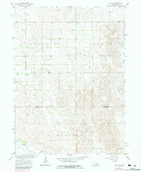
Beaver Creek and Blacksnake Creek drain this landscape on the border of Antelope and Boone counties. This early 1960s survey documents a rural environment organized into township divisions such as Lincoln, Logan, and Oakland. The settlement pattern is defined by a strictly rectangular grid of section lines and property boundaries, many of which are specifically marked as fence lines. Local social centers are few but significant, represented by the Townhall and School No 91. The topography reveals the transition from the rolling drainage basins of the Missouri River Basin project to the more level agricultural plots. This map serves as a primary record of the mid-century infrastructure in this section of the Nebraska plains, preserving the location of farmsteads and rural school districts before the consolidation of many local townships.
Find a feature on this map
8 named features on this map. Tap any name to fly to it.
Don’t see what you’re looking for? This feature index may not catch every label — zoom into the map to look around manually.
Map Details
Editions of this 1963 Elgin NW Map
3 editions found
Other maps of this area

1955 · Broken Bow
USGS Topo · 1:250,000

1955 · O'Neill
USGS Topo · 1:250,000

1956 · Broken Bow
USGS Topo · 1:250,000

1959 · O'Neill
USGS Topo · 1:250,000

1960 · Spalding 2 NE
USGS Topo · 1:24,000

1960 · Spalding 2 SE
USGS Topo · 1:24,000

1963 · Petersburg
USGS Topo · 1:24,000

1963 · Neligh SE
USGS Topo · 1:24,000

1963 · Deloit
USGS Topo · 1:24,000

1963 · Neligh SW
USGS Topo · 1:24,000