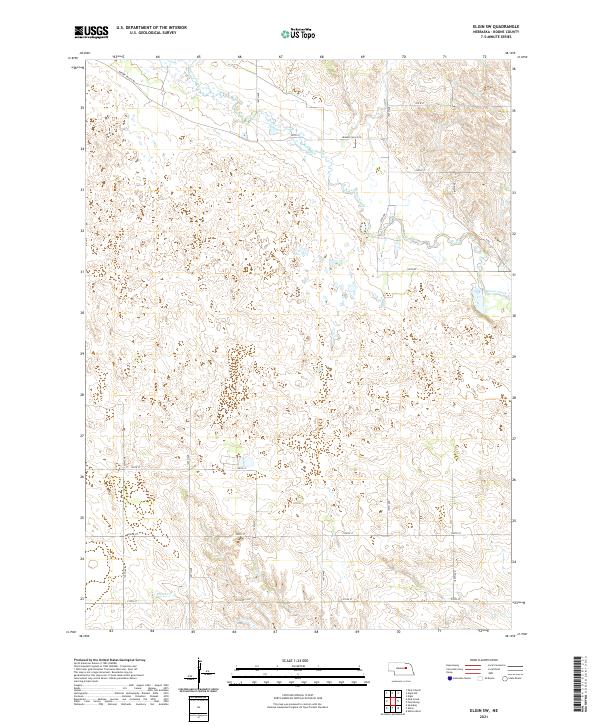
2021 Map of Elgin SW
USGS Topo · Published 2021About this map
Beaver Creek and its associated tributaries, including Plum Cr, define the drainage patterns across this agricultural section of Boone County. The landscape is organized by a strict section-line grid of roads, most notably Beaver Valley Rd, which follows the northern valley, and north-south corridors like 150th Ave and 180th Ave. This area represents the classic Jeffersonian grid system, where the township and range boundaries—including t22n r8w and t21n r7w—dictate the placement of farmstead access and transport routes. The map illustrates the subtle topography between the stream valleys, where small wetlands and stock ponds appear alongside the local road network of numbered streets and avenues, such as 200th St and 130th Ave, serving this rural Nebraska landscape.
Find a feature on this map
21 named features on this map. Tap any name to fly to it.
Don’t see what you’re looking for? This feature index may not catch every label — zoom into the map to look around manually.
Map Details
Editions of this 2021 Elgin SW Map
This is the sole edition of this map. No revisions or reprints were ever made.
Other maps of this area

1954 · Spalding
USGS Topo · 1:24,000

1954 · Akron
USGS Topo · 1:24,000

1954 · Albion West
USGS Topo · 1:24,000

1955 · Broken Bow
USGS Topo · 1:250,000

1956 · Broken Bow
USGS Topo · 1:250,000

1960 · Spalding 2 NE
USGS Topo · 1:24,000

1960 · Spalding 2 SE
USGS Topo · 1:24,000

1963 · Petersburg
USGS Topo · 1:24,000

1963 · Elgin NW
USGS Topo · 1:24,000
1963 · Elgin SW
USGS Topo · 1:24,000