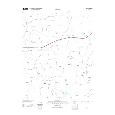
2013 Map of Eli
USGS Topo · Published 2013About this map
Lake Cumberland defines the southern reaches of this landscape, where the rising waters of the reservoir meet a network of steep hollows and narrow ridges. The settlement of Eli sits centrally on a high plateau, serving as a hub for local routes like Reid/Hart Rd and Harristown Rd. The terrain is deeply incised by drainages such as Puncheon Camp Cr and Goose Cr in the north, while the south is characterized by numerous family-named landmarks including Gosser Ridge, Parks Ridge, and Ono Ridge.
Find a feature on this map
150 named features on this map. Tap any name to fly to it.
Don’t see what you’re looking for? This feature index may not catch every label — zoom into the map to look around manually.
Map Details
Editions of this 2013 Eli Map
This is the sole edition of this map. No revisions or reprints were ever made.
Other maps of this area

1911 · Monticello
USGS Topo · 1:62,500

1914 · Monticello
USGS Topo · 1:62,500

1953 · Phil
USGS Topo · 1:24,000

1953 · Mintonville
USGS Topo · 1:24,000

1953 · Mill Springs
USGS Topo · 1:24,000

1953 · Jamestown
USGS Topo · 1:24,000

1953 · Dunnville
USGS Topo · 1:24,000

1954 · Jabez
USGS Topo · 1:24,000

1954 · Russell Springs
USGS Topo · 1:24,000

1954 · Eli
USGS Topo · 1:24,000