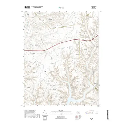
2019 Map of Eli
USGS Topo · Published 2019About this map
Lake Cumberland defines the southern reaches of this landscape, where the inundated valleys of Alligator Cr and Wolf Cr meet the upland ridges of Russell County. This modern survey illustrates a rural settlement pattern concentrated along prominent high ground, with communities like Eli, Whittle, and Dorena situated near the intersection of ridge roads. The topography is deeply dissected, characterized by numerous hollows such as Wells Hollow, Gable Hollow, and Possum Hollow that drain toward the reservoir. For local historians and genealogists, the map preserves the location of family-named landmarks and resting places, including the Whittle Cem and Thomas Cem. The transition from the agricultural plateaus of Bethany Ridge and Roytown Ridge down to the irregular shoreline of the lake highlights the impact of mid-century water management on the region's traditional geography.
Find a feature on this map
140 named features on this map. Tap any name to fly to it.
Don’t see what you’re looking for? This feature index may not catch every label — zoom into the map to look around manually.
Map Details
Editions of this 2019 Eli Map
This is the sole edition of this map. No revisions or reprints were ever made.
Other maps of this area

1911 · Monticello
USGS Topo · 1:62,500

1914 · Monticello
USGS Topo · 1:62,500

1953 · Phil
USGS Topo · 1:24,000

1953 · Mintonville
USGS Topo · 1:24,000

1953 · Mill Springs
USGS Topo · 1:24,000

1953 · Jamestown
USGS Topo · 1:24,000

1953 · Dunnville
USGS Topo · 1:24,000

1954 · Jabez
USGS Topo · 1:24,000

1954 · Russell Springs
USGS Topo · 1:24,000

1954 · Eli
USGS Topo · 1:24,000