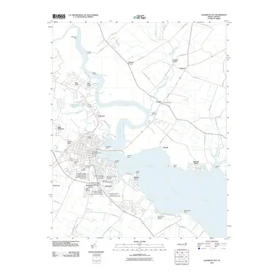
2010 Map of Elizabeth City
USGS Topo · Published 2010About this map
Elizabeth City State University anchors the southern portion of this coastal landscape, showing a dense campus layout including Williams Hall and the K E White Graduate Center. The Pasquotank River dominates the geography, winding past several named islands like Goat Island and Reed Island before widening as it approaches the sound. Residential expansion is evident in various suburban developments such as Winslow Acres, Brite Meadows, and Brookridge Terrace. On the eastern bank, the smaller settlement of Camden is visible alongside the Camden Post Office and Lambs Marina. This 2010 depiction reflects a modern riverfront community where traditional water-dependent sites like Shipyard Landing coexist with regional infrastructure like the Elizabeth City Municipal Airport.
Find a feature on this map
76 named features on this map. Tap any name to fly to it.
Don’t see what you’re looking for? This feature index may not catch every label — zoom into the map to look around manually.
Map Details
Editions of this 2010 Elizabeth City Map
This is the sole edition of this map. No revisions or reprints were ever made.
Other maps of this area

1906 · Hertford
USGS Topo · 1:62,500

1940 · Hertford
USGS Topo · 1:62,500

1940 · Wade Point
USGS Topo · 1:62,500

1940 · South Mills
USGS Topo · 1:62,500

1943 · Wade Point
USGS Topo · 1:62,500

1948 · Wade Point
USGS Topo · 1:62,500

1948 · Elizabeth City
USGS Topo · 1:62,500

1952 · South Mills
USGS Topo · 1:62,500

1953 · Norfolk
USGS Topo · 1:250,000

1982 · Nixonton
USGS Topo · 1:24,000