
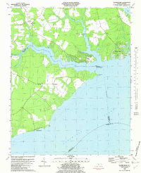
1982 Map of Nixonton
USGS Topo · Published 1982About this map
The Little River and Perquimans River define the intricate, water-locked landscape of this coastal North Carolina region. Small farming communities and crossroads such as Nixonton, Woodville, and New Hope anchor the inland reaches, connected by a network of rural roads including Highway 17. The map illustrates a high density of local institutions that are vital for family history research, particularly country churches like Woodland Ch and Galatia Ch, alongside several family-named burial sites including Wilson Cem and Godfrey Cem. The peninsula of Durants Neck extends into the river system, highlighting the area's historical reliance on maritime access at points like Redbank Landing and the Boat Ramp. The presence of the Whitehurst Airstrip and scattered landmarks like Rabbit Corner reflect the mid-20th-century transition of this tidewater agricultural district.
Find a feature on this map
33 named features on this map. Tap any name to fly to it.
Don’t see what you’re looking for? This feature index may not catch every label — zoom into the map to look around manually.
Map Details
Editions of this 1982 Nixonton Map
This is the sole edition of this map. No revisions or reprints were ever made.
Other maps of this area

1906 · Hertford
USGS Topo · 1:62,500

1940 · Hertford
USGS Topo · 1:62,500

1940 · Wade Point
USGS Topo · 1:62,500

1940 · South Mills
USGS Topo · 1:62,500

1943 · Wade Point
USGS Topo · 1:62,500

1948 · Wade Point
USGS Topo · 1:62,500

1948 · Elizabeth City
USGS Topo · 1:62,500

1952 · South Mills
USGS Topo · 1:62,500

1953 · Norfolk
USGS Topo · 1:250,000
1982 · Yeopim River
USGS Topo · 1:24,000