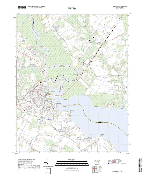
2022 Map of Elizabeth City
USGS Topo · Published 2022About this map
Elizabeth City serves as the focal point of this coastal plain landscape, situated along the western banks of the Pasquotank River. The map highlights a significant academic and civic presence, featuring the Elizabeth City State University campus, College of the Albemarle, and the Pasquotank County Courthouse. Across the river, the settlement of Camden is home to the Camden County Courthouse, illustrating the administrative division between Pasquotank and Camden counties.
Find a feature on this map
191 named features on this map. Tap any name to fly to it.
Don’t see what you’re looking for? This feature index may not catch every label — zoom into the map to look around manually.
Map Details
Editions of this 2022 Elizabeth City Map
This is the sole edition of this map. No revisions or reprints were ever made.
Other maps of this area

1906 · Hertford
USGS Topo · 1:62,500

1940 · Hertford
USGS Topo · 1:62,500

1940 · Wade Point
USGS Topo · 1:62,500

1940 · South Mills
USGS Topo · 1:62,500

1943 · Wade Point
USGS Topo · 1:62,500

1948 · Wade Point
USGS Topo · 1:62,500

1948 · Elizabeth City
USGS Topo · 1:62,500

1952 · South Mills
USGS Topo · 1:62,500

1953 · Norfolk
USGS Topo · 1:250,000

1982 · Nixonton
USGS Topo · 1:24,000