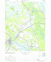
1948 Map of Elizabeth City
USGS Topo · Published 1976About this map
Elizabeth City anchors the southwestern corner of this survey, where the Pasquotank River widens as it flows toward the sound. The mid-century landscape is defined by its relationship to water and timber, with the Norfolk Southern Railroad cutting a straight diagonal through the interior to connect rural depots like Belcross and Shawboro. To the north and east, the massive wetlands of the Dismal Swamp and Great Swamp dominate the topography, segmented by man-made waterways such as the Roland Creek Canal and Mill Run Canal. Smaller settlements like Indian Town, home to a Lumber Mill, suggest the local economic reliance on the surrounding forests. Along the eastern edge, the North River meanders through marshland, while the southern shoreline features localized recreational and residential spots like Texaco Beach near Shiloh.
Find a feature on this map
45 named features on this map. Tap any name to fly to it.
Don’t see what you’re looking for? This feature index may not catch every label — zoom into the map to look around manually.
Map Details
Editions of this 1948 Elizabeth City Map
2 editions found

Other maps of this area

1893 · Virginia Beach
USGS Topo · 1:125,000

1906 · Hertford
USGS Topo · 1:62,500

1916 · Back Bay
USGS Topo · 1:62,500

1939 · Moyock
USGS Topo · 1:62,500

1940 · Barco
USGS Topo · 1:62,500

1940 · Hertford
USGS Topo · 1:62,500

1940 · Powells Point
USGS Topo · 1:62,500

1940 · Lake Drummond
USGS Topo · 1:62,500

1940 · Wade Point
USGS Topo · 1:62,500

1940 · South Mills
USGS Topo · 1:62,500