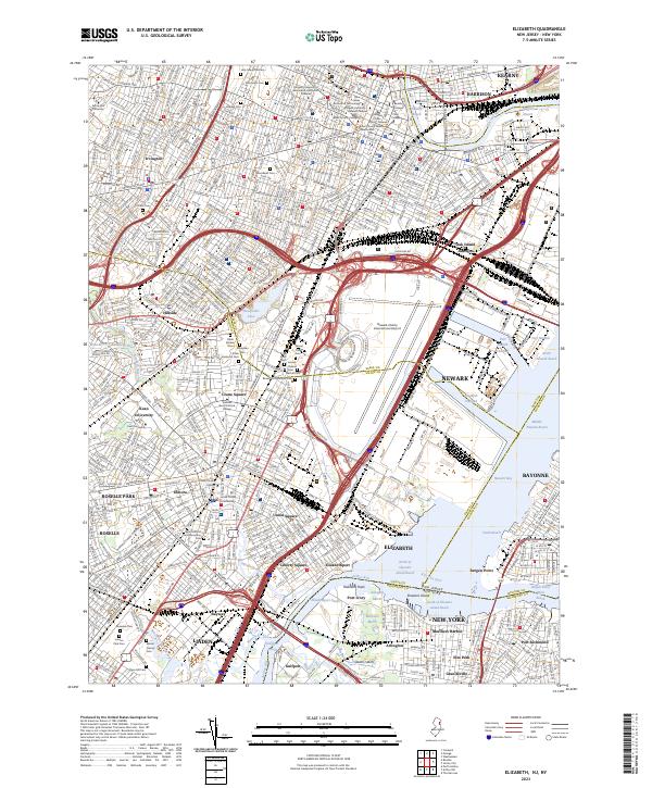
1995 Map of Elizabeth
USGS Topo · Published 1998About this map
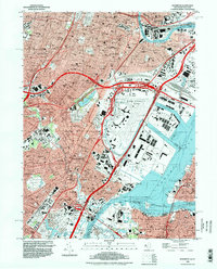
Industrial corridors and dense urban centers dominate this region of New Jersey as it appeared in the mid-1990s. The massive footprint of Newark International Airport sits at the heart of a complex transportation network where the New Jersey Turnpike Extension and the Pulaski Skyway converge near Oak Island Yards. Along the waterways, the heavy maritime infrastructure of Port Newark and Port Ivory underscores the area's role as a global logistics hub, while the Elizabeth Channel and Kill Van Kull define the busy shipping lanes between the mainland and Staten Island.
Find a feature on this map
68 named features on this map. Tap any name to fly to it.
Don’t see what you’re looking for? This feature index may not catch every label — zoom into the map to look around manually.
Map Details
Editions of this 1995 Elizabeth Map
This is the sole edition of this map. No revisions or reprints were ever made.
Historical Maps of Kearny Through Time
5 maps found