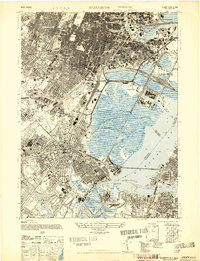
1947 Map of Elizabeth
USGS Topo · Published 1947About this map
Newark Airport and the Port of Newark dominate the central marshlands of this mid-century survey, illustrating the industrial and logistical expansion into the meadowlands of Elizabeth and Newark. The map reveals a dense urban fabric extending from the commercial centers of Harrison and Irvington down to the bustling waterfront of Elizabethport. Transportation is the primary driver of this landscape, with the Passaic River and Newark Bay hosting a complex network of shipping channels like the North Channel, while the Lackawanna Ry and multiple passenger stations facilitate heavy commuter and freight traffic.
Find a feature on this map
74 named features on this map. Tap any name to fly to it.
Don’t see what you’re looking for? This feature index may not catch every label — zoom into the map to look around manually.
Map Details
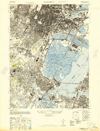
Editions of this 1947 Elizabeth Map
2 editions found
Other maps of this area

1888 · Plainfield
USGS Topo · 1:62,500

1888 · Morristown
USGS Topo · 1:62,500

1888 · Paterson
USGS Topo · 1:62,500

1892 · Paterson
USGS Topo · 1:62,500

1893 · Plainfield
USGS Topo · 1:62,500

1894 · Morristown
USGS Topo · 1:62,500

1898 · Morristown
USGS Topo · 1:62,500

1898 · Plainfield
USGS Topo · 1:62,500

1898 · Staten Island
USGS Topo · 1:62,500

1898 · Paterson
USGS Topo · 1:62,500