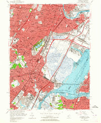
1955 Map of Elizabeth
USGS Topo · Published 1964About this map
Industrial corridors and dense residential neighborhoods dominate this mid-century survey of northeastern New Jersey, anchored by the massive footprints of Newark Airport and Port Newark. The landscape is a complex web of transport infrastructure, featuring the New Jersey Turnpike, the Pulaski Skyway, and the extensive yards of the Pennsylvania Railroad. In Elizabeth and Newark, the urban fabric is tightly knit with local institutions like St Elizabeth Hospital and St Marys Sch & Ch. To the west, the residential character of Irvington and Hillside is punctuated by large green spaces such as Weequahic Park and Warinanco Park. Significant genealogical resources are documented throughout, including the sprawling Evergreen Cemetery and Rosehill Cemetery, alongside academic landmarks like Seton Hall College. The map also captures the transition across the Arthur Kill via the Goethals Bridge to the north shore of Staten Island, showing the industrial waterfronts of Port Ivory and Mariners Harbor.
Find a feature on this map
143 named features on this map. Tap any name to fly to it.
Don’t see what you’re looking for? This feature index may not catch every label — zoom into the map to look around manually.
Map Details
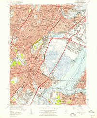
Editions of this 1955 Elizabeth Map
2 editions found
Other maps of this area

1888 · Plainfield
USGS Topo · 1:62,500

1888 · Morristown
USGS Topo · 1:62,500

1888 · Paterson
USGS Topo · 1:62,500

1892 · Paterson
USGS Topo · 1:62,500

1893 · Plainfield
USGS Topo · 1:62,500

1894 · Morristown
USGS Topo · 1:62,500

1898 · Morristown
USGS Topo · 1:62,500

1898 · Plainfield
USGS Topo · 1:62,500

1898 · Staten Island
USGS Topo · 1:62,500

1898 · Paterson
USGS Topo · 1:62,500