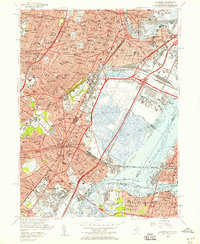
1955 Map of Elizabeth
USGS Topo · Published 1958About this map
Industrial and transport infrastructure dominates the landscape of Newark and Elizabeth during this mid-century period. The massive footprint of Newark Airport and the expanding Port Newark waterfront along Newark Bay stand adjacent to complex rail yards and interchanges for the New Jersey Turnpike and the Garden State Parkway. This survey provides a precise record of the dense residential and educational fabric of the era, from Seton Hall University in the north to numerous parochial institutions like St Benedicts Sch and Sacred Heart Sch. Further south, the map illustrates the heavy rail corridors of the Pennsylvania RR and Central RR of New Jersey as they move through Linden and Elizabethport, while open spaces like Evergreen Cemetery and Weequahic Park provide significant green breaks in the urban grid.
Find a feature on this map
85 named features on this map. Tap any name to fly to it.
Don’t see what you’re looking for? This feature index may not catch every label — zoom into the map to look around manually.
Map Details
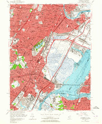
Editions of this 1955 Elizabeth Map
2 editions found
Other maps of this area

1888 · Plainfield
USGS Topo · 1:62,500

1888 · Morristown
USGS Topo · 1:62,500

1888 · Paterson
USGS Topo · 1:62,500

1892 · Paterson
USGS Topo · 1:62,500

1893 · Plainfield
USGS Topo · 1:62,500

1894 · Morristown
USGS Topo · 1:62,500

1898 · Morristown
USGS Topo · 1:62,500

1898 · Plainfield
USGS Topo · 1:62,500

1898 · Staten Island
USGS Topo · 1:62,500

1898 · Paterson
USGS Topo · 1:62,500