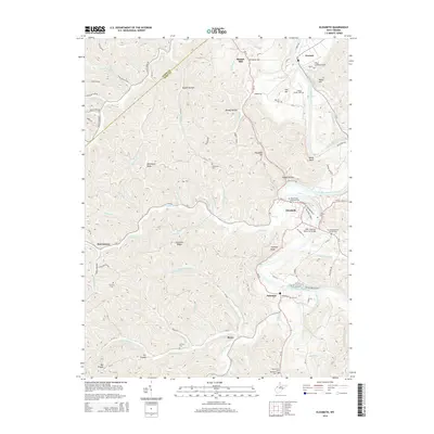
2014 Map of Elizabeth
USGS Topo · Published 2014About this map
The Little Kanawha River carves a winding path through this portion of Wirt County, anchoring the town of Elizabeth, where the WWII Veterans Memorial Bridge spans the water. This 2014 survey captures a landscape defined by sharp ridges like Courtney Ridge and Morehead Ridge, which separate the many hollows and runs that feed into the river system. Genealogists will find a high density of small family and community burial grounds, including the Beauchamp Newman Cem and the Antioch Cem near Rover. To the north, Newark sits along Lee Cr, while the smaller settlements of Palestine and Morristown mark the rural crossroads. The topography is notably complex, with prominent landmarks such as Jephany Knob and Elizabeth Hill rising above the bottomlands where agricultural and residential pockets cluster along the Little Kanawha River.
Find a feature on this map
76 named features on this map. Tap any name to fly to it.
Don’t see what you’re looking for? This feature index may not catch every label — zoom into the map to look around manually.
Map Details
Editions of this 2014 Elizabeth Map
This is the sole edition of this map. No revisions or reprints were ever made.
Other maps of this area

1906 · Elizabeth
USGS Topo · 1:62,500

1906 · Belleville
USGS Topo · 1:62,500

1907 · Spencer
USGS Topo · 1:62,500

1907 · Ripley
USGS Topo · 1:62,500

1924 · Belleville
USGS Topo · 1:62,500

1924 · Elizabeth
USGS Topo · 1:62,500

1926 · Elizabeth
USGS Topo · 1:62,500

1926 · Belleville
USGS Topo · 1:62,500

1926 · Ripley
USGS Topo · 1:62,500

1928 · Spencer
USGS Topo · 1:62,500