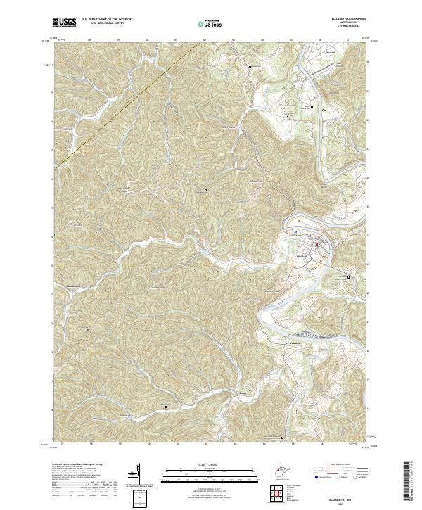
2023 Map of Elizabeth
USGS Topo · Published 2023About this map
The Little Kanawha River dictates the landscape of this Wirt County survey, winding past the county seat at Elizabeth and the smaller settlements of Palestine and Newark. The town of Elizabeth serves as the civic anchor, dominated by the Wirt County Courthouse and a network of named streets including Juliana St and Washington St. The surrounding terrain is characterized by a dense system of ridges and hollows, such as Morehead Ridge, Courtney Ridge, and Bloody Hollow, which have historically limited development to the narrow valley floors and hilltop clearings.
Find a feature on this map
102 named features on this map. Tap any name to fly to it.
Don’t see what you’re looking for? This feature index may not catch every label — zoom into the map to look around manually.
Map Details
Editions of this 2023 Elizabeth Map
This is the sole edition of this map. No revisions or reprints were ever made.
Other maps of this area

1906 · Elizabeth
USGS Topo · 1:62,500

1906 · Belleville
USGS Topo · 1:62,500

1907 · Spencer
USGS Topo · 1:62,500

1907 · Ripley
USGS Topo · 1:62,500

1924 · Belleville
USGS Topo · 1:62,500

1924 · Elizabeth
USGS Topo · 1:62,500

1926 · Elizabeth
USGS Topo · 1:62,500

1926 · Belleville
USGS Topo · 1:62,500

1926 · Ripley
USGS Topo · 1:62,500

1928 · Spencer
USGS Topo · 1:62,500