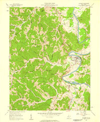
1957 Map of Elizabeth
USGS Topo · Published 1958About this map
The Little Kanawha River winds sharply through Wirt County, anchoring the town of Elizabeth and the smaller settlement of Palestine. In the late 1950s, this landscape was defined by the transition from river-based infrastructure to rural development. Downstream from Elizabeth, the Lock & Dam (Ruins) alongside a Gaging Sta reflect a legacy of river navigation, while the nearby Palestine State Fish Hatchery highlights mid-century conservation efforts.
Find a feature on this map
65 named features on this map. Tap any name to fly to it.
Don’t see what you’re looking for? This feature index may not catch every label — zoom into the map to look around manually.
Map Details
Editions of this 1957 Elizabeth Map
2 editions found
Other maps of this area

1906 · Elizabeth
USGS Topo · 1:62,500

1906 · Belleville
USGS Topo · 1:62,500

1907 · Spencer
USGS Topo · 1:62,500

1907 · Ripley
USGS Topo · 1:62,500

1924 · Belleville
USGS Topo · 1:62,500

1924 · Elizabeth
USGS Topo · 1:62,500

1926 · Elizabeth
USGS Topo · 1:62,500

1926 · Belleville
USGS Topo · 1:62,500

1926 · Ripley
USGS Topo · 1:62,500

1928 · Spencer
USGS Topo · 1:62,500