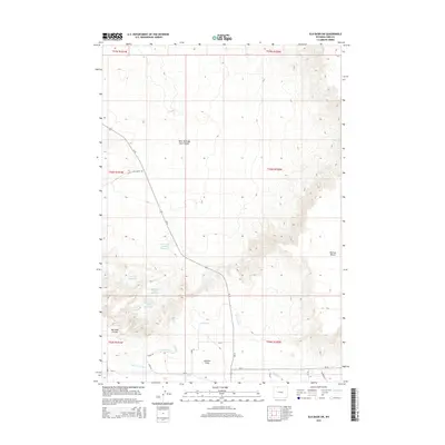
2015 Map of Elk Basin SW
USGS Topo · Published 2015About this map
Ralston Flats sits at the heart of this Wyoming landscape, where the arid high desert meets a complex network of man-made water management. The terrain is defined by the sharp rise of Polecat Bench to the east and the deep drainages of West Fork Big Sand Coulee. The map reveals an intricate system of agricultural irrigation, featuring various canals and laterals such as the Ralston Lateral and Lateral H-141. This water infrastructure supports a series of catchment areas, including Cat Track Reservoir, Middle Sand Coulee Reservoir, and Upper Sand Coulee Reservoir. The arrangement of these reservoirs and the surrounding Alkali Cr Patch highlights the era's ongoing efforts to harness runoff in a region dominated by sagebrush and intermittent streams like N Alkali Cr.
Find a feature on this map
28 named features on this map. Tap any name to fly to it.
Don’t see what you’re looking for? This feature index may not catch every label — zoom into the map to look around manually.
Map Details
Editions of this 2015 Elk Basin SW Map
This is the sole edition of this map. No revisions or reprints were ever made.
Other maps of this area

1949 · Cody
USGS Topo · 1:62,500

1950 · Clark
USGS Topo · 1:62,500

1951 · Cody
USGS Topo · 1:62,500

1955 · Cody
USGS Topo · 1:250,000

1958 · Cody
USGS Topo · 1:250,000

1962 · Cody
USGS Topo · 1:250,000

1966 · Elk Basin SW
USGS Topo · 1:24,000

1966 · Elk Basin
USGS Topo · 1:24,000

1966 · Elk Basin NW
USGS Topo · 1:24,000

1966 · Elk Basin SE
USGS Topo · 1:24,000