
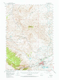
1949 Map of Cody
USGS Topo · Published 1962About this map
Cody serves as the focal point of this mid-century survey, positioned along the Shoshone River where the plains meet the high desert mountains. The map illustrates a landscape shaped by irrigation and ranching, featuring the Heart Mountain Canal and the Ralston Lateral that support agricultural life on the Ralston Flats. To the west, the topography rises sharply into the Shoshone National Forest, dominated by the massive Rattlesnake Mountain and the towering Heart Mountain.
Find a feature on this map
70 named features on this map. Tap any name to fly to it.
Don’t see what you’re looking for? This feature index may not catch every label — zoom into the map to look around manually.
Map Details
Editions of this 1949 Cody Map
2 editions found
Other maps of this area

1911 · Oregon Basin
USGS Topo · 1:62,500

1913 · Oregon Basin
USGS Topo · 1:62,500

1949 · Pat O'Hara Mountain
USGS Topo · 1:62,500

1950 · Clark
USGS Topo · 1:62,500

1950 · Deep Lake
USGS Topo · 1:62,500

1951 · Cody
USGS Topo · 1:62,500

1955 · Cody
USGS Topo · 1:250,000

1957 · Wapiti
USGS Topo · 1:62,500

1957 · Devils Tooth
USGS Topo · 1:62,500

1958 · Cody
USGS Topo · 1:250,000